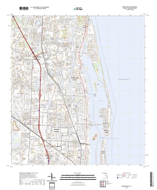
2024 Map of Riviera Beach
USGS Topo · Published 2024About this map
Lake Worth dominates the coastal geography of this contemporary Florida survey, separating the mainland settlements of Riviera Beach and North Palm Beach from the barrier island communities. The intricate marine environment is defined by the Intracoastal Waterway and the narrow passage of the Lake Worth Inlet, which connects the inner lagoons to the Atlantic Ocean. Inland, the landscape reflects dense suburban and institutional development, including the Palm Beach State College campus and the sprawling VA Medical Center. Local history is preserved in sites like Glenwood Memorial Cem and Royal Palm Memorial Gardens. The map provides a detailed view of the modern infrastructure and drainage systems, such as the North Palm Beach Waterway and the Loxahatchee Canal, which manage the region's low-lying terrain.
Find a feature on this map
39 named features on this map. Tap any name to fly to it.
Don’t see what you’re looking for? This feature index may not catch every label — zoom into the map to look around manually.
Map Details
Editions of this 2024 Riviera Beach Map
This is the sole edition of this map. No revisions or reprints were ever made.
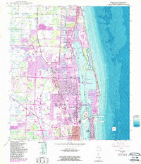
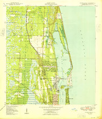
Historical Maps of Palm Beach Shores Through Time
3 maps found