
1955 Map of Roach Lake
USGS Topo · Published 1957About this map
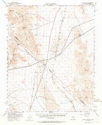
Mining operations and desert transportation networks dominate this 1950s survey of the Nevada and California borderlands. The landscape is defined by the dry beds of Roach Lake and Ivanpah Lake, providing flat expanses across which the Union Pacific railroad and the Old Traction Road navigate the high desert. To the west, the Devil Peak Mountains and the Clark Mountain Range harbor numerous mineral prospects, including the Christmas Mine, New Year Mine, and Addison Mine. Small rail-dependent settlements such as Borax, Roach, and Calada dot the corridor, serving as vital outposts in a region where water is scarce, as indicated by the infrequent presence of a Well. This era shows the region just before modern interstate development, highlighting the historic Von Schmidt Line as a critical boundary for early surveyors and miners.
Find a feature on this map
28 named features on this map. Tap any name to fly to it.
Don’t see what you’re looking for? This feature index may not catch every label — zoom into the map to look around manually.
Map Details
Editions of this 1955 Roach Lake Map
4 editions found
Other maps of this area

1910 · Ivanpah
USGS Topo · 1:250,000

1912 · Ivanpah
USGS Topo · 1:250,000

1942 · Ivanpah
USGS Topo · 1:250,000

1947 · Kingman
USGS Topo · 1:250,000

1948 · Kingman
USGS Topo · 1:250,000

1954 · Kingman
USGS Topo · 1:250,000

1955 · Kingman
USGS Topo · 1:250,000

1955 · Mescal Range
USGS Topo · 1:62,500

1956 · Ivanpah
USGS Topo · 1:62,500

1956 · Clark Mountain
USGS Topo · 1:62,500