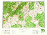
1963 Map of Roanoke
USGS Topo · Published 1963About this map
The Blue Ridge Mountains and Alleghany Mountains dominate this mid-century survey, illustrating the complex topographic gateway between the Piedmont and the Shenandoah Valley. Urban centers like Roanoke and Lynchburg emerge as vital industrial hubs, their growth inextricably linked to the massive rail networks of the Norfolk and Western and Chesapeake and Ohio railroads. The map captures the region during a period of significant hydroelectric and recreational development, most notably with the formation of Smith Mountain Lake on the Roanoke River.
Find a feature on this map
127 named features on this map. Tap any name to fly to it.
Don’t see what you’re looking for? This feature index may not catch every label — zoom into the map to look around manually.
Map Details
Editions of this 1963 Roanoke Map
This is the sole edition of this map. No revisions or reprints were ever made.
Other maps of this area

1887 · Spottsylvania
USGS Topo · 1:125,000

1887 · Lewisburg
USGS Topo · 1:125,000

1890 · Goochland
USGS Topo · 1:125,000

1890 · Roanoke
USGS Topo · 1:125,000

1890 · Christiansburg
USGS Topo · 1:125,000

1891 · Roanoke
USGS Topo · 1:125,000

1891 · Palmyra
USGS Topo · 1:125,000

1891 · Farmville
USGS Topo · 1:125,000

1891 · Lewisburg
USGS Topo · 1:125,000

1891 · Huntersville
USGS Topo · 1:125,000