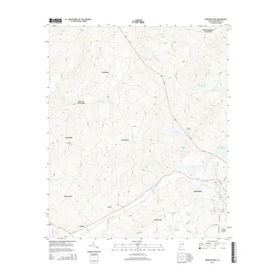
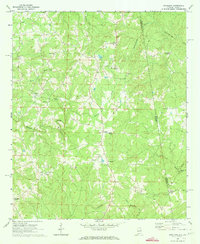
2014 Map of Roanoke West
USGS Topo · Published 2014About this map
Roanoke serves as the focal point of this Randolph County landscape, situated where the terrain begins its descent toward the valleys of High Pine Creek and Town Creek. The map documents a predominantly rural environment defined by numerous small named settlements and crossroads like White Signboard Crossroad, Broughton, and Dickert. These communities are often anchored by local heritage sites, including the Friendship Cem near the Friendship settlement and Union Hill Cem further east.
Find a feature on this map
95 named features on this map. Tap any name to fly to it.
Don’t see what you’re looking for? This feature index may not catch every label — zoom into the map to look around manually.
Map Details
Editions of this 2014 Roanoke West Map
This is the sole edition of this map. No revisions or reprints were ever made.
Other maps of this area

1891 · Ashland
USGS Topo · 1:125,000

1899 · Wedowee
USGS Topo · 1:125,000

1902 · Wedowee
USGS Topo · 1:125,000

1953 · Atlanta
USGS Topo · 1:250,000

1957 · Atlanta
USGS Topo · 1:250,000

1958 · Atlanta
USGS Topo · 1:250,000
1968 · Five Points
USGS Topo · 1:24,000
1969 · Roanoke East
USGS Topo · 1:24,000
1969 · Wadley North
USGS Topo · 1:24,000
1969 · Napoleon
USGS Topo · 1:24,000