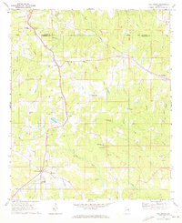
1968 Map of Five Points
USGS Topo · Published 1973About this map
The Central of Georgia and Seaboard Coast Line railroads anchor the rural landscape of eastern Alabama in the late 1960s, converging near the community of Five Points. This topography shows a network of small settlements and post offices tied to the rail lines and creek valleys, including Stroud, Welch, and the curiously named Standing Rock. Agricultural and industrial history is evident at Cumbee Mill on Gross Creek, while the civic life of the era is recorded through numerous rural congregations such as Mt Pisgah Ch, Sweet Home Ch, and St Pauls Ch. The map captures the dividing line between Chambers and Randolph counties, punctuated by family-named landmarks like Meacham and Finley. Educational facilities like Phillips High Sch serve the scattered population, while an Old Railroad Grade in the east hints at an even older era of local transport.
Find a feature on this map
35 named features on this map. Tap any name to fly to it.
Don’t see what you’re looking for? This feature index may not catch every label — zoom into the map to look around manually.
Map Details
Editions of this 1968 Five Points Map
2 editions found
Other maps of this area

1899 · Wedowee
USGS Topo · 1:125,000

1902 · Wedowee
USGS Topo · 1:125,000

1907 · Opelika
USGS Topo · 1:125,000

1909 · Opelika
USGS Topo · 1:125,000

1953 · Atlanta
USGS Topo · 1:250,000

1955 · Phenix City
USGS Topo · 1:250,000

1957 · Phenix City
USGS Topo · 1:250,000

1957 · Atlanta
USGS Topo · 1:250,000

1958 · Phenix City
USGS Topo · 1:250,000

1958 · Atlanta
USGS Topo · 1:250,000