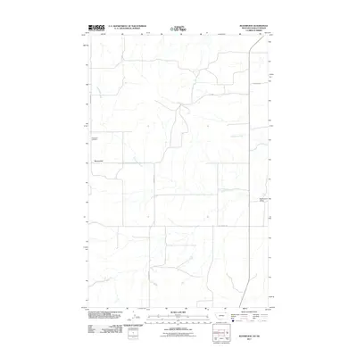
2011 Map of Roanwood
USGS Topo · Published 2011About this map
Roanwood defines this portion of Valley County, situated within the wider Roanwood Valley landscape. This northern Montana area is characterized by its drainage network, primarily shaped by the meandering paths of Roanwood Creek and Mosquito Creek. For those tracing local roots, the Roanwood Cemetery serves as a primary landmark for the settlement. The map highlights a rural transportation grid that facilitates access through this open terrain, including significant thoroughfares such as Roanwood Rd, N Nelson Rd, and Old Theony Rd. These roads reflect the long-standing land divisions and section lines that have organized the regional ranching and agricultural operations for generations.
Find a feature on this map
9 named features on this map. Tap any name to fly to it.
Don’t see what you’re looking for? This feature index may not catch every label — zoom into the map to look around manually.
Map Details
Editions of this 2011 Roanwood Map
This is the sole edition of this map. No revisions or reprints were ever made.
Other maps of this area

1919 · Boundary
USGS Topo · 1:125,000

1954 · Glasgow
USGS Topo · 1:250,000

1957 · Glasgow
USGS Topo · 1:250,000

1958 · Glasgow
USGS Topo · 1:250,000

1973 · Glentana West
USGS Topo · 1:24,000

1973 · Opheim
USGS Topo · 1:24,000

1973 · Roanwood
USGS Topo · 1:24,000
1973 · Glass Hill
USGS Topo · 1:24,000

1984 · O'Juel Lake
USGS Topo · 1:24,000

1984 · Opheim
USGS Topo · 1:100,000