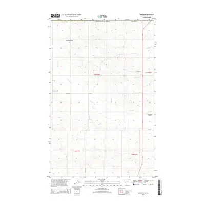
2014 Map of Roanwood
USGS Topo · Published 2014About this map
The Roanwood Valley landscape in Valley County reveals a sparse but persistent settlement pattern characteristic of northeast Montana. Centered on the community of Roanwood, the area is defined by the drainage of Roanwood Creek as it winds toward the southern portions of the quadrangle. Agricultural and ranching interests are evident in the grid of local roads, such as Roanwood Rd and Stelflug Rd, which provide access across the township lines of t37n r40e and t37n r41e. The northern boundary of the map follows the international border of the United States, placing this remote prairie region at the very edge of the state. For genealogists and local historians, the Roanwood Cemetery serves as a primary landmark for tracing the families who settled this high-plains terrain near Mosquito Creek.
Find a feature on this map
17 named features on this map. Tap any name to fly to it.
Don’t see what you’re looking for? This feature index may not catch every label — zoom into the map to look around manually.
Map Details
Editions of this 2014 Roanwood Map
This is the sole edition of this map. No revisions or reprints were ever made.
Other maps of this area

1919 · Boundary
USGS Topo · 1:125,000

1954 · Glasgow
USGS Topo · 1:250,000

1957 · Glasgow
USGS Topo · 1:250,000

1958 · Glasgow
USGS Topo · 1:250,000

1973 · Glentana West
USGS Topo · 1:24,000

1973 · Opheim
USGS Topo · 1:24,000

1973 · Roanwood
USGS Topo · 1:24,000
1973 · Glass Hill
USGS Topo · 1:24,000

1984 · O'Juel Lake
USGS Topo · 1:24,000

1984 · Opheim
USGS Topo · 1:100,000