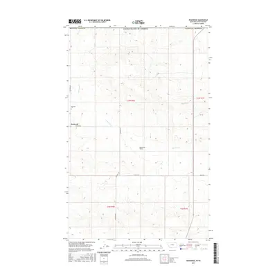
2017 Map of Roanwood
USGS Topo · Published 2017About this map
Roanwood Valley dominates this landscape in northeastern Valley County, where the topography transitions into the high plains near the international border. The small settlement of Roanwood and the nearby Roanwood Cem serve as focal points for this rural community. The area's hydrology is defined by the winding paths of Roanwood Cr and Mosquito Cr, which drain the undulating terrain. A network of local routes, including Roanwood Rd, 3-P Rd, and 4 Corner W Rd, reflects a landscape organized by section-line grazing and farming interests. This map provides a clear record of land use and property boundaries under the Public Land Survey System, specifically within townships T37N R40E and T36N R40E, preserving the layout of this remote corner of Montana.
Find a feature on this map
16 named features on this map. Tap any name to fly to it.
Don’t see what you’re looking for? This feature index may not catch every label — zoom into the map to look around manually.
Map Details
Editions of this 2017 Roanwood Map
This is the sole edition of this map. No revisions or reprints were ever made.
Other maps of this area

1919 · Boundary
USGS Topo · 1:125,000

1954 · Glasgow
USGS Topo · 1:250,000

1957 · Glasgow
USGS Topo · 1:250,000

1958 · Glasgow
USGS Topo · 1:250,000

1973 · Glentana West
USGS Topo · 1:24,000

1973 · Opheim
USGS Topo · 1:24,000

1973 · Roanwood
USGS Topo · 1:24,000
1973 · Glass Hill
USGS Topo · 1:24,000

1984 · O'Juel Lake
USGS Topo · 1:24,000

1984 · Opheim
USGS Topo · 1:100,000