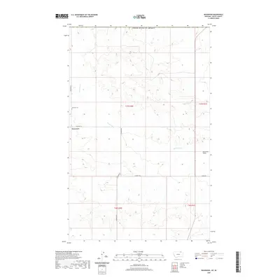
2020 Map of Roanwood
USGS Topo · Published 2020About this map
Roanwood and Roanwood Valley anchor this remote section of Valley County, Montana, situated just south of the international border with the United States of America. The landscape is defined by the drainage patterns of Roanwood Cr and Mosquito Cr, which carve through the high plains. Human presence is sparse, marked primarily by a grid of rural routes including Roanwood Rd and 4 Corner W Rd. The Roanwood Cem remains a significant landmark for those researching the genealogy and early settlement of this northern frontier. The map clearly delineates the township and range lines, such as t37n r40e and t36n r41e, which have governed land division in this cattle and wheat country since the original homesteading era.
Find a feature on this map
13 named features on this map. Tap any name to fly to it.
Don’t see what you’re looking for? This feature index may not catch every label — zoom into the map to look around manually.
Map Details
Editions of this 2020 Roanwood Map
This is the sole edition of this map. No revisions or reprints were ever made.
Other maps of this area

1919 · Boundary
USGS Topo · 1:125,000

1954 · Glasgow
USGS Topo · 1:250,000

1957 · Glasgow
USGS Topo · 1:250,000

1958 · Glasgow
USGS Topo · 1:250,000

1973 · Glentana West
USGS Topo · 1:24,000

1973 · Opheim
USGS Topo · 1:24,000

1973 · Roanwood
USGS Topo · 1:24,000
1973 · Glass Hill
USGS Topo · 1:24,000

1984 · O'Juel Lake
USGS Topo · 1:24,000

1984 · Opheim
USGS Topo · 1:100,000