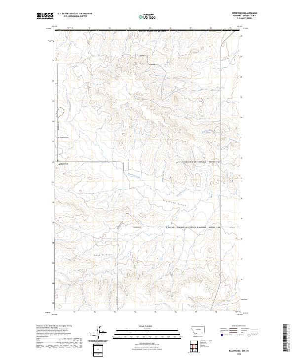
2024 Map of Roanwood
USGS Topo · Published 2024About this map
Roanwood and its surrounding agricultural valley anchor this northern Montana landscape near the international border. The settlement is centered at the junction of Roanwood Rd, which runs south through the Roanwood Valley, and several section-line roads like 4 Corner W Rd and Mason Rd. The terrain is characterized by the significant relief of the Opheim Hills, which rise above the drainages of Roanwood Creek and Mosquito Creek. For genealogists and local historians, the Roanwood Cem located north of the town site serves as a vital landmark for tracing early families in this corner of Valley County. The network of unimproved roads, including 3-P Rd, suggests a landscape dedicated to large-scale ranching and dryland farming, where movement follows the natural contours of the hills and coulees.
Find a feature on this map
15 named features on this map. Tap any name to fly to it.
Don’t see what you’re looking for? This feature index may not catch every label — zoom into the map to look around manually.
Map Details
Editions of this 2024 Roanwood Map
This is the sole edition of this map. No revisions or reprints were ever made.
Other maps of this area

1919 · Boundary
USGS Topo · 1:125,000

1954 · Glasgow
USGS Topo · 1:250,000

1957 · Glasgow
USGS Topo · 1:250,000

1958 · Glasgow
USGS Topo · 1:250,000

1973 · Glentana West
USGS Topo · 1:24,000

1973 · Opheim
USGS Topo · 1:24,000

1973 · Roanwood
USGS Topo · 1:24,000
1973 · Glass Hill
USGS Topo · 1:24,000

1984 · O'Juel Lake
USGS Topo · 1:24,000

1984 · Opheim
USGS Topo · 1:100,000