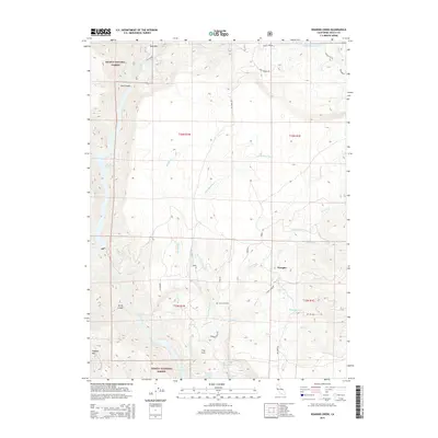
2015 Map of Roaring Creek
USGS Topo · Published 2015About this map
Shasta National Forest dominates this northern California landscape, defined by the deep incisions of Iron Canyon and Devils Canyon. The hydroelectric infrastructure along the Pit River is a primary feature, with Tunnel Reservoir, Pit Six Reservoir, and Pit 7 Reservoir capturing the river's descent. These engineering works stand in contrast to the small-scale human settlements like Wengler, The Cove, and Bush Bar. Local history is anchored at the Cove Cemetery near the confluence of Roaring Cr and Little Roaring Cr. The network of forest roads, including Roaring Ridge Rd and Big Bend Rd, traces the ridges above numerous waterways such as Hatchet Cr, home to the Hatchet Creek Falls. This survey illustrates the managed balance between utility production and protected timberland in the early 21st century.
Find a feature on this map
38 named features on this map. Tap any name to fly to it.
Don’t see what you’re looking for? This feature index may not catch every label — zoom into the map to look around manually.
Map Details
Editions of this 2015 Roaring Creek Map
This is the sole edition of this map. No revisions or reprints were ever made.
Other maps of this area

1886 · Lassen Peak
USGS Topo · 1:250,000

1886 · Modoc Lava Bed
USGS Topo · 1:250,000

1886 · Shasta
USGS Topo · 1:250,000

1890 · Red Bluff
USGS Topo · 1:250,000

1892 · Modoc Lava-Bed
USGS Topo · 1:250,000

1892 · Lassen Peak
USGS Topo · 1:250,000

1894 · Lassen Peak
USGS Topo · 1:250,000

1894 · Red Bluff
USGS Topo · 1:250,000

1894 · Shasta
USGS Topo · 1:250,000

1901 · Redding
USGS Topo · 1:125,000