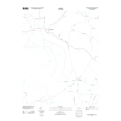
2013 Map of Roaring Spring
USGS Topo · Published 2013About this map
La Fayette and the surrounding Christian County countryside are defined by a network of rural roads and family-named cemeteries at the start of the 2010s. The landscape is split by the northern edge of the Fort Campbell Military Res, where Artillery Rd and Noahs Spring Br mark the boundary between civil and military lands. A dense concentration of historical burial sites, including Dawson Cem, Powell Cem, and Hester Cem, suggests deep genealogical roots in this agricultural region. Transportation patterns follow a mix of older thoroughfares like the Old Clarksville Pike and localized routes such as Roaring Springs Rd, which connects the namesake community of Roaring Spring to the broader river valley drainage of the Little River and Casey Cr.
Find a feature on this map
44 named features on this map. Tap any name to fly to it.
Don’t see what you’re looking for? This feature index may not catch every label — zoom into the map to look around manually.
Map Details
Editions of this 2013 Roaring Spring Map
This is the sole edition of this map. No revisions or reprints were ever made.
Other maps of this area

1950 · Caledonia
USGS Topo · 1:24,000

1951 · Church Hill
USGS Topo · 1:24,000

1951 · Caledonia
USGS Topo · 1:24,000

1951 · Roaring Spring
USGS Topo · 1:24,000

1951 · Johnson Hollow
USGS Topo · 1:24,000

1951 · Indian Mound
USGS Topo · 1:24,000

1951 · Bumpus Mills
USGS Topo · 1:24,000

1951 · Herndon
USGS Topo · 1:24,000

1951 · Woodlawn
USGS Topo · 1:24,000
1953 · Cadiz
USGS Topo · 1:24,000