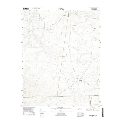
2016 Map of Roaring Spring
USGS Topo · Published 2016About this map
LaFayette and Roaring Spring anchor this landscape along the Kentucky-Tennessee border, where the rural character of Christian County is defined by its small cemeteries and winding creek beds. Family history is etched into the terrain through sites like Dawson Cem, Simmons Cem, and Carter Cem, many situated near established local routes such as Military Rd and Old Clarksville Pike. The hydrology of the region is centered on the Little River and several drainage systems including Skinner Cr, Casey Cr, and Noahs Spring Br. South of the state line, the presence of Artillery Rd and W Perimiter Rd indicates the transition into controlled territory, while the northern sections remain dominated by agricultural road networks and scattered rural residences.
Find a feature on this map
46 named features on this map. Tap any name to fly to it.
Don’t see what you’re looking for? This feature index may not catch every label — zoom into the map to look around manually.
Map Details
Editions of this 2016 Roaring Spring Map
This is the sole edition of this map. No revisions or reprints were ever made.
Other maps of this area

1950 · Caledonia
USGS Topo · 1:24,000

1951 · Church Hill
USGS Topo · 1:24,000

1951 · Caledonia
USGS Topo · 1:24,000

1951 · Roaring Spring
USGS Topo · 1:24,000

1951 · Johnson Hollow
USGS Topo · 1:24,000

1951 · Indian Mound
USGS Topo · 1:24,000

1951 · Bumpus Mills
USGS Topo · 1:24,000

1951 · Herndon
USGS Topo · 1:24,000

1951 · Woodlawn
USGS Topo · 1:24,000
1953 · Cadiz
USGS Topo · 1:24,000