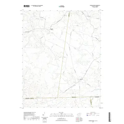
2019 Map of Roaring Spring
USGS Topo · Published 2019About this map
Roaring Spring and the nearby community of LaFayette anchor this study of the rolling borderlands between Kentucky and Tennessee. The landscape is defined by its rural cemetery network, including Corinth Cem, Dawson Cem, and Powell Cem, which often serve as the primary markers of historic family settlements and local heritage. The terrain is dissected by watercourses like Little River, Casey Cr, and Noahs Spring Br, while a complex system of roads such as Military Rd and Old Clarksville Pike reflects the historic transportation corridors of Christian and Trigg counties. The map illustrates the convergence of agricultural land and wooded drainages along the state line, providing a clear record of property boundaries and local landmarks as they existed in the late 2010s.
Find a feature on this map
45 named features on this map. Tap any name to fly to it.
Don’t see what you’re looking for? This feature index may not catch every label — zoom into the map to look around manually.
Map Details
Editions of this 2019 Roaring Spring Map
This is the sole edition of this map. No revisions or reprints were ever made.
Other maps of this area

1950 · Caledonia
USGS Topo · 1:24,000

1951 · Church Hill
USGS Topo · 1:24,000

1951 · Caledonia
USGS Topo · 1:24,000

1951 · Roaring Spring
USGS Topo · 1:24,000

1951 · Johnson Hollow
USGS Topo · 1:24,000

1951 · Indian Mound
USGS Topo · 1:24,000

1951 · Bumpus Mills
USGS Topo · 1:24,000

1951 · Herndon
USGS Topo · 1:24,000

1951 · Woodlawn
USGS Topo · 1:24,000
1953 · Cadiz
USGS Topo · 1:24,000