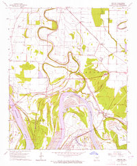
1964 Map of Rob Roy
USGS Topo · Published 1965About this map
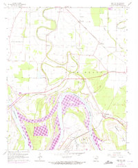
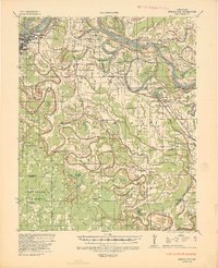
Arkansas River bottomlands dominate this mid-century survey, revealing a landscape defined by the intricate winding of Plum Bayou and Black Bayou through the fertile delta plains. The settlement of Rob Roy sits near the river's edge, adjacent to the St Louis Southwestern railroad line that served the local agricultural economy. The map provides significant genealogical value, documenting numerous rural congregations and resting places including St Marks Ch, St Marys Cem, and Cottonwood Ch, many of which were central to the identity of small communities like Haywood and Ellison.
Find a feature on this map
45 named features on this map. Tap any name to fly to it.
Don’t see what you’re looking for? This feature index may not catch every label — zoom into the map to look around manually.
Map Details
Editions of this 1964 Rob Roy Map
2 editions found
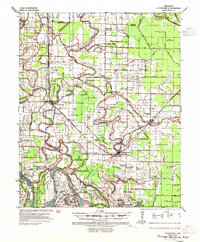
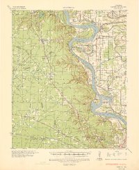
Other maps of this area

1932 · Pastoria
USGS Topo · 1:62,500
1935 · Altheimer
USGS Topo · 1:62,500
1935 · Pastoria
USGS Topo · 1:62,500
1935 · Noble Lake
USGS Topo · 1:62,500

1948 · Helena
USGS Topo · 1:250,000

1950 · Helena
USGS Topo · 1:250,000

1955 · Helena
USGS Topo · 1:250,000

1955 · Little Rock
USGS Topo · 1:250,000

1956 · Little Rock
USGS Topo · 1:250,000

1959 · Helena
USGS Topo · 1:250,000