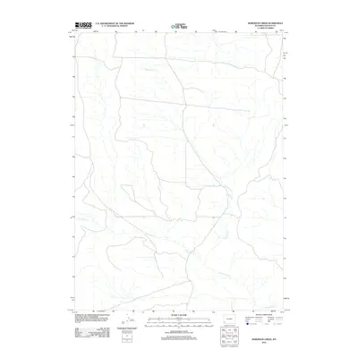
2012 Map of Roberson Creek
USGS Topo · Published 2012About this map
Roberson Cr and Dry Muddy Cr wind through this high-altitude drainage basin in Lincoln County, providing the primary hydrological structure for the region. The landscape is defined by the confluence of these seasonal and perennial waterways, which traditionally served as vital water sources for livestock and local wildlife. At Roberson Spring, a localized water source appears as a distinct point of interest in an otherwise arid expanse. This survey, grounded in data from the National Hydrography Dataset and the National Elevation Dataset, highlights the intricate drainage patterns that characterize the western Wyoming interior. The absence of major settlements emphasizes the pastoral and open-range character of the territory during this period.
Find a feature on this map
3 named features on this map. Tap any name to fly to it.
Don’t see what you’re looking for? This feature index may not catch every label — zoom into the map to look around manually.
Map Details
Editions of this 2012 Roberson Creek Map
This is the sole edition of this map. No revisions or reprints were ever made.
Other maps of this area

1954 · Ogden
USGS Topo · 1:250,000

1958 · Ogden
USGS Topo · 1:250,000

1960 · Ogden
USGS Topo · 1:250,000

1969 · Church Butte NW
USGS Topo · 1:24,000

1969 · Willow Springs
USGS Topo · 1:24,000

1969 · Roberson Creek
USGS Topo · 1:24,000

1969 · Hampton
USGS Topo · 1:24,000
1969 · Church Butte
USGS Topo · 1:24,000
1969 · Mulkay Spring
USGS Topo · 1:24,000
1969 · Opal
USGS Topo · 1:24,000