
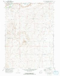
1969 Map of Roberson Creek
USGS Topo · Published 1972About this map
Roberson Creek and Dry Muddy Creek dominate the drainage patterns of this high-desert landscape in southwest Wyoming, as recorded by the Geological Survey during a 1969 field check. The terrain is defined by complex contouring and significant elevation shifts, revealing a region largely shaped by intermittent water flow and erosion. A prominent Pipeline cuts across the western and central sections of the quadrangle, signaling the area's role in the regional energy infrastructure of the late 1960s. Aside from Roberson Spring, which provides a rare named water source, the map shows a landscape marked by survey markers and section lines, reflecting the sparsely settled and utilitarian nature of this corner of Lincoln County during the era.
Find a feature on this map
9 named features on this map. Tap any name to fly to it.
Don’t see what you’re looking for? This feature index may not catch every label — zoom into the map to look around manually.
Map Details
Editions of this 1969 Roberson Creek Map
2 editions found
Other maps of this area

1954 · Ogden
USGS Topo · 1:250,000

1958 · Ogden
USGS Topo · 1:250,000

1960 · Ogden
USGS Topo · 1:250,000

1969 · Church Butte NW
USGS Topo · 1:24,000

1969 · Willow Springs
USGS Topo · 1:24,000

1969 · Hampton
USGS Topo · 1:24,000
1969 · Church Butte
USGS Topo · 1:24,000
1969 · Mulkay Spring
USGS Topo · 1:24,000
1969 · Opal
USGS Topo · 1:24,000
1969 · Little Round Mountain
USGS Topo · 1:24,000