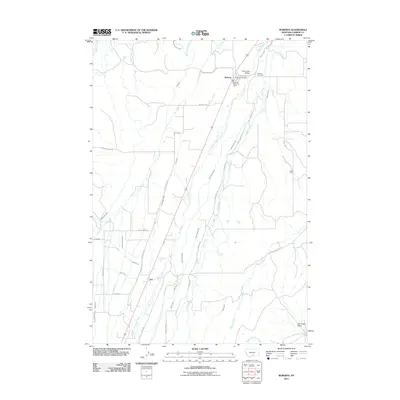
2011 Map of Roberts
USGS Topo · Published 2011About this map
Rock Creek and its many supporting irrigation works define the agricultural character of this Carbon County landscape. The settlement of Roberts serves as the local hub, anchored by the Roberts Post Office and the Roberts Rural Fire Dist 6, while the Roberts Cemetery sits just to the northeast. An intricate system of water management is visible through named features like the Finn Ditch, Kivikangas Ditch, and Wentworth Ditch, illustrating how the high plains terrain has been adapted for ranching and farming. South of Roberts, the small community of Fox marks a crossing point near Rock Creek, while further east, Sigel Farm and the Dry Creek Basin show the transition toward more open country. This survey provides a clear record of the area's rural road network, including the Roberts-Willow Creek Rd and Elbow Creek Rd, which connect the scattered homesteads and water crossings.
Find a feature on this map
45 named features on this map. Tap any name to fly to it.
Don’t see what you’re looking for? This feature index may not catch every label — zoom into the map to look around manually.
Map Details
Editions of this 2011 Roberts Map
This is the sole edition of this map. No revisions or reprints were ever made.
Other maps of this area

1932 · Red Lodge No 2
USGS Topo · 1:48,000

1932 · Red Lodge No 1
USGS Topo · 1:48,000

1944 · Red Lodge
USGS Topo · 1:62,500

1954 · Billings
USGS Topo · 1:250,000

1956 · Roscoe NE
USGS Topo · 1:24,000

1956 · Roberts
USGS Topo · 1:24,000

1956 · Mount Maurice
USGS Topo · 1:62,500

1956 · Castagne
USGS Topo · 1:24,000
1956 · Boyd
USGS Topo · 1:24,000

1956 · The Big Slide
USGS Topo · 1:24,000