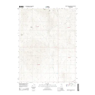
2014 Map of Roberts Creek Mountain
USGS Topo · Published 2014About this map
Roberts Creek Mtn and the surrounding Roberts Mountains dominate this high-altitude interior Nevada landscape. The 2014 terrain is defined by a series of drainages, including Pete Hanson Canyon to the north and Cottonwood Canyon to the west, which channel seasonal snowmelt into lower basins. Human presence is sparse, marked primarily by water management and access routes. The Roberts Cr Reservoir serves as a critical focal point in the southern portion of the quadrangle, collecting flow from Roberts Creek and Cherry Spring. Transportation is limited to rugged paths such as Dry Creek Rd and Henderson Roberts Creek Rd, which provide access to this ranching and grazing country. The map clearly delineates the Township and Range boundaries, such as t23n r50e, highlighting the systematic organization of these public lands.
Find a feature on this map
16 named features on this map. Tap any name to fly to it.
Don’t see what you’re looking for? This feature index may not catch every label — zoom into the map to look around manually.
Map Details
Editions of this 2014 Roberts Creek Mountain Map
This is the sole edition of this map. No revisions or reprints were ever made.
Other maps of this area

1926 · Roberts Mountains
USGS Topo · 1:250,000

1929 · Roberts Mountains
USGS Topo · 1:250,000

1949 · Garden Valley
USGS Topo · 1:62,500

1949 · Roberts Creek Mtn
USGS Topo · 1:62,500

1951 · Roberts Creek Mtn
USGS Topo · 1:62,500

1951 · Garden Valley
USGS Topo · 1:62,500

1955 · Millett
USGS Topo · 1:250,000

1956 · Bartine Ranch
USGS Topo · 1:62,500

1956 · Whistler Mtn
USGS Topo · 1:62,500

1959 · Millett
USGS Topo · 1:250,000