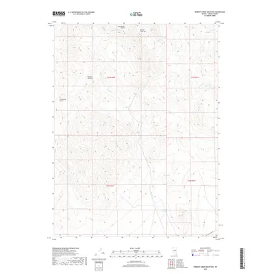
2018 Map of Roberts Creek Mountain
USGS Topo · Published 2018About this map
Roberts Creek Mtn and the broader Roberts Mountains dominate this high-desert landscape in Eureka County, where seasonal drainages carve deep incisions through the terrain. The hydrological network is defined by several key watercourses, including Roberts Cr, which flows southward toward the Roberts Cr Reservoir near the base of the range. To the north and west, the terrain breaks into steep-walled corridors such as Pete Hanson Canyon and Cottonwood Canyon, while isolated water sources like Cherry Spring provided essential stopovers in an otherwise arid environment. Transportation through this remote section of Nevada is limited, primarily represented by Garden Pass Rd in the southeast corner. This 2018 survey illustrates a land largely managed for its natural resources and watershed value, with a topography that dictates movement and settlement patterns based on the availability of water from creeks like Vinini Cr and Pete-Hanson Cr.
Find a feature on this map
16 named features on this map. Tap any name to fly to it.
Don’t see what you’re looking for? This feature index may not catch every label — zoom into the map to look around manually.
Map Details
Editions of this 2018 Roberts Creek Mountain Map
This is the sole edition of this map. No revisions or reprints were ever made.
Other maps of this area

1926 · Roberts Mountains
USGS Topo · 1:250,000

1929 · Roberts Mountains
USGS Topo · 1:250,000

1949 · Garden Valley
USGS Topo · 1:62,500

1949 · Roberts Creek Mtn
USGS Topo · 1:62,500

1951 · Roberts Creek Mtn
USGS Topo · 1:62,500

1951 · Garden Valley
USGS Topo · 1:62,500

1955 · Millett
USGS Topo · 1:250,000

1956 · Bartine Ranch
USGS Topo · 1:62,500

1956 · Whistler Mtn
USGS Topo · 1:62,500

1959 · Millett
USGS Topo · 1:250,000