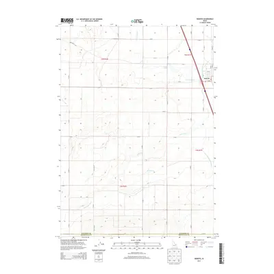
2013 Map of Roberts
USGS Topo · Published 2013About this map
The small town of Roberts serves as the focal point for this 2013 survey, where the intersection of water and land management is on full display in Jefferson County. An intricate network of irrigation systems, including the Bell Larsen Canal, Butte Market Lake Canal, and Poltevin Ditch, defines the local economy and landscape, showing how the high desert has been adapted for agriculture. The terrain transition is marked by natural features like Taylor Slough and man-made infrastructure such as the McCarthy Ditch and Kettle Butte Drain, which regulate the flow across the Snake River Plain. Transportation is centered on a grid of rural routes, from the long-reaching Pole Line Rd to Mud Lake Rd, facilitating movement between the fields and the town center. The southern portion of the sheet reaches the border between Jefferson Co and Bonneville Co, anchoring the map in its regional context.
Find a feature on this map
38 named features on this map. Tap any name to fly to it.
Don’t see what you’re looking for? This feature index may not catch every label — zoom into the map to look around manually.
Map Details
Editions of this 2013 Roberts Map
This is the sole edition of this map. No revisions or reprints were ever made.
Other maps of this area

1948 · Lewisville
USGS Topo · 1:24,000

1948 · Idaho Falls North
USGS Topo · 1:24,000

1949 · Idaho Falls North
USGS Topo · 1:24,000

1949 · Lewisville
USGS Topo · 1:24,000

1949 · Roberts
USGS Topo · 1:62,500

1949 · Roberts
USGS Topo · 1:24,000

1949 · Shattuck Butte
USGS Topo · 1:24,000

1950 · Shattuck Butte
USGS Topo · 1:24,000

1950 · Roberts
USGS Topo · 1:24,000

1955 · Idaho Falls
USGS Topo · 1:250,000