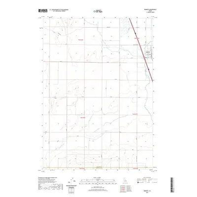
2020 Map of Roberts
USGS Topo · Published 2020About this map
Agricultural infrastructure and water management systems define the landscape around Roberts in the early 21st century. This Jefferson County settlement sits at the junction of several critical waterways, including the Butte Market Lake Canal and the meandering Taylor Slough. The land is meticulously partitioned by a network of drainage and irrigation features such as the Poitevin Ditch, McCarthy Ditch, and the Bell Larsen Canal, which support the local farming economy. Near the town center, a Po serves as a focal point for the community. The southern portion of the map transitions toward the Jefferson Co Bonneville Co boundary, where the terrain is marked by the Kettle-Butte Drain. A grid of rural roads, including the descriptively named Farm To Market Rd, facilitates transport between the scattered homesteads and the central rail-and-canal hub at Roberts.
Find a feature on this map
29 named features on this map. Tap any name to fly to it.
Don’t see what you’re looking for? This feature index may not catch every label — zoom into the map to look around manually.
Map Details
Editions of this 2020 Roberts Map
This is the sole edition of this map. No revisions or reprints were ever made.
Other maps of this area

1948 · Lewisville
USGS Topo · 1:24,000

1948 · Idaho Falls North
USGS Topo · 1:24,000

1949 · Idaho Falls North
USGS Topo · 1:24,000

1949 · Lewisville
USGS Topo · 1:24,000

1949 · Roberts
USGS Topo · 1:62,500

1949 · Roberts
USGS Topo · 1:24,000

1949 · Shattuck Butte
USGS Topo · 1:24,000

1950 · Shattuck Butte
USGS Topo · 1:24,000

1950 · Roberts
USGS Topo · 1:24,000

1955 · Idaho Falls
USGS Topo · 1:250,000