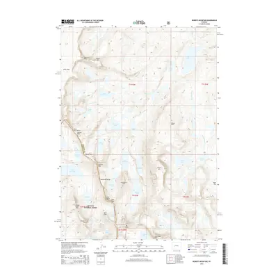
2015 Map of Roberts Mountain
USGS Topo · Published 2015About this map
The Continental Divide carves a high-altitude path through this portion of the Wind River Range, marking the crest between the Sublette Co and Fremont Co border. Situated within the Bridger National Forest, the landscape is defined by an immense network of alpine basins and glacial lakes, including Lake Heebecheeche, Lake Kagevah, and Lake Solitude. The drainage patterns are complex, with the N Fork Little Wind River and its tributaries such as Glacier Cr flowing eastward, while waters like Middle Fork Lake sit on the western slope. Massive granite features dominate the skyline, notably Roberts Mtn, Mt Lander, and Wolverine Peak. The presence of several 4wd routes and the crossing at Kagevah Pass indicates the challenging access routes used by backcountry travelers and forest rangers in this high-wilderness environment during the mid-2010s.
Find a feature on this map
56 named features on this map. Tap any name to fly to it.
Don’t see what you’re looking for? This feature index may not catch every label — zoom into the map to look around manually.
Map Details
Editions of this 2015 Roberts Mountain Map
This is the sole edition of this map. No revisions or reprints were ever made.
Other maps of this area

1937 · Moccasin Lake
USGS Topo · 1:48,000

1938 · Mt Bonneville
USGS Topo · 1:62,500

1941 · Mt Bonneville
USGS Topo · 1:62,500

1942 · Mt Bonneville
USGS Topo · 1:62,500

1943 · Moccasin Lake
USGS Topo · 1:62,500

1952 · Paradise Basin
USGS Topo · 1:24,000

1952 · St. Lawrence Basin
USGS Topo · 1:24,000

1952 · Alpine Lake
USGS Topo · 1:24,000

1955 · Thermopolis
USGS Topo · 1:250,000

1955 · Lander
USGS Topo · 1:250,000