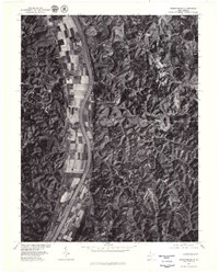
1977 Map of Robertsburg
USGS Topo · Published 1979About this map
The Kanawha River dominates this orthophotoquad, its broad valley supporting a linear mosaic of cultivated fields that contrast sharply with the densely forested uplands of Mason County. This 1977 aerial perspective reveals the river-oriented settlement patterns of the late 1970s, where small riverfront communities like Robertsburg, Southside, and Leon occupy the fertile bottomlands. Further inland, the landscape shifts to the narrow, winding valleys of Thirteenmile Creek and the steep, timbered slopes of Manila Ridge. The orthophoto format provides a clear view of land use, from the precise geometry of flood-plain agriculture to the scattered homesteads in rural enclaves such as Waterloo, Arbuckle, and Manila. This survey is particularly useful for identifying specific building locations and forest boundaries as they existed shortly after the mid-century peak of West Virginia's rural agriculture.
Find a feature on this map
10 named features on this map. Tap any name to fly to it.
Don’t see what you’re looking for? This feature index may not catch every label — zoom into the map to look around manually.
Map Details
Editions of this 1977 Robertsburg Map
This is the sole edition of this map. No revisions or reprints were ever made.
Other maps of this area

1906 · Glenwood
USGS Topo · 1:62,500

1906 · Winfield
USGS Topo · 1:62,500

1908 · Glenwood
USGS Topo · 1:62,500

1908 · Winfield
USGS Topo · 1:62,500

1908 · Ravenswood
USGS Topo · 1:62,500

1908 · Point Pleasant
USGS Topo · 1:62,500

1926 · Ravenswood
USGS Topo · 1:62,500

1926 · Point Pleasant
USGS Topo · 1:62,500

1928 · Ravenswood
USGS Topo · 1:62,500

1929 · Point Pleasant
USGS Topo · 1:62,500