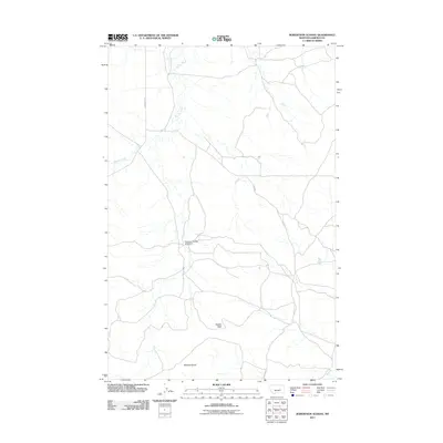
2011 Map of Robertson School
USGS Topo · Published 2011About this map
Robertson School (Historical) stands as a focal point in this sparsely settled portion of Garfield County, marking the site of former community life in the Montana plains. The landscape is defined by the winding course of Big Dry Creek, which cuts through the northern half of the map, and Sand Cr in the southeast. Named locations like Hawks Nest and Robbers Roost suggest a history of early landmarks used for navigation or habitation in an area where human imprints are few. The road network is limited to a handful of routes such as Edwards Rd and Fitch Rd, reflecting the remote ranching character of the region. This survey captures a moment in the early 21st century where the primary reminders of earlier settlement patterns are preserved through historical labels and traditional topographic naming.
Find a feature on this map
8 named features on this map. Tap any name to fly to it.
Don’t see what you’re looking for? This feature index may not catch every label — zoom into the map to look around manually.
Map Details
Editions of this 2011 Robertson School Map
This is the sole edition of this map. No revisions or reprints were ever made.
Other maps of this area

1954 · Jordan
USGS Topo · 1:250,000

1954 · Forsyth
USGS Topo · 1:250,000

1956 · Jordan
USGS Topo · 1:250,000

1957 · Forsyth
USGS Topo · 1:250,000

1958 · Jordan
USGS Topo · 1:250,000

1958 · Forsyth
USGS Topo · 1:250,000

1964 · Jordan
USGS Topo · 1:250,000

1965 · Robertson School
USGS Topo · 1:24,000

1965 · Big Dry School
USGS Topo · 1:24,000

1965 · Edwards
USGS Topo · 1:24,000