
1924 Map of Robertson
USGS Topo · Published 1924About this map
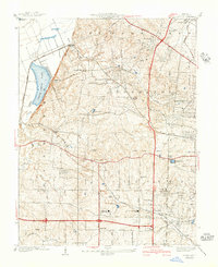
Lambert St Louis Landing Field marks the burgeoning aviation history of St. Louis County along the southern edge of this mid-1930s revision. The terrain transitions from the alluvial bottomlands of the Missouri River to the rolling hills of Ferdinand and Bonhomme. This era shows a landscape shifting toward modernization, with established local institutions like Garret School and Bonfils School serving the rural population while the Wabash railroad and newly named thoroughfares like Lindbergh Blvd signal the expansion of the metropolitan periphery.
Find a feature on this map
26 named features on this map. Tap any name to fly to it.
Don’t see what you’re looking for? This feature index may not catch every label — zoom into the map to look around manually.
Map Details
Editions of this 1924 Robertson Map
This is the sole edition of this map. No revisions or reprints were ever made.
Other maps of this area

1903 · O'Fallon
USGS Topo · 1:125,000

1927 · St. Charles
USGS Topo · 1:62,500

1931 · Brussels
USGS Topo · 1:62,500

1932 · Manchester NE
USGS Topo · 1:24,000

1933 · Creve Coeur
USGS Topo · 1:24,000

1933 · Clayton
USGS Topo · 1:24,000

1933 · Saint Charles
USGS Topo · 1:62,500

1935 · Florissant
USGS Topo · 1:24,000

1939 · Brussels
USGS Topo · 1:62,500
1940 · Creve Coeur
USGS Topo · 1:24,000