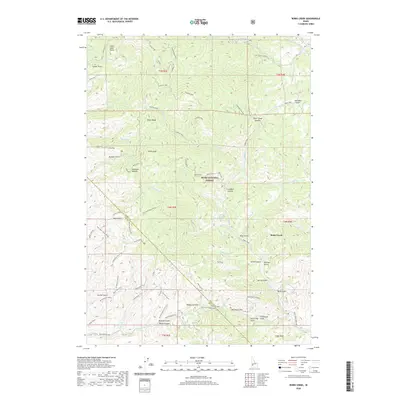
2020 Map of Robie Creek
USGS Topo · Published 2020About this map
Boise National Forest dominates this landscape northeast of Boise, where the high peaks of the Boise Ridge divide the drainage basins of the Boise River. The settlement at Robie Creek sits at the confluence of several mountain streams, including South Fork Robie Creek and N Fork Robie Cr. A dense network of trails and forestry roads, such as Femrite's Patrol, Watchman Trail, and the 5 Mile Gulch Trail, reveals a terrain heavily utilized for recreation and resource management. Notable high points like Gardiner Peak and Boise Peak stand above deep drainages like Hulls Gulch and Rocky Canyon. Near the eastern edge, Harrington Airport serves as a remote landing strip, while summits such as Eagleson Summit and Aldape Summit mark the primitive road crossings between these high Idaho gulches.
Find a feature on this map
75 named features on this map. Tap any name to fly to it.
Don’t see what you’re looking for? This feature index may not catch every label — zoom into the map to look around manually.
Map Details
Editions of this 2020 Robie Creek Map
This is the sole edition of this map. No revisions or reprints were ever made.
Other maps of this area

1892 · Boise
USGS Topo · 1:125,000

1894 · Idaho Basin
USGS Topo · 1:125,000

1897 · Boise
USGS Topo · 1:125,000

1949 · Robie Creek
USGS Topo · 1:24,000

1954 · Boise South
USGS Topo · 1:24,000

1954 · Boise North
USGS Topo · 1:24,000

1954 · Boise
USGS Topo · 1:62,500

1955 · Hailey
USGS Topo · 1:250,000

1955 · Boise
USGS Topo · 1:250,000

1957 · Cartwright Canyon
USGS Topo · 1:24,000