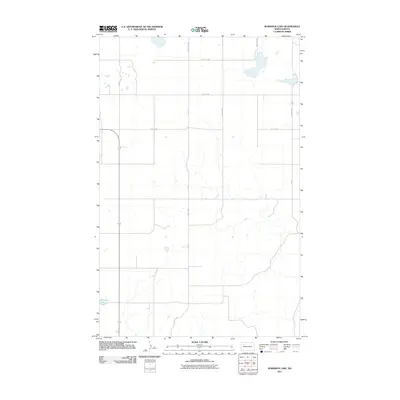
2011 Map of Robinson Lake
USGS Topo · Published 2011About this map
Robinson Lake serves as the focal point for this section of the High Plains, where the landscape is organized by a precise grid of rural section roads. This 2011 survey by the U.S. Geological Survey details the intersection of local routes like 57th St NW and 90th Ave NW, illustrating the agricultural layout typical of Mountrail County. The geography is characterized by numerous small, unlabelled prairie potholes and seasonal wetlands that dot the terrain between the established thoroughfares of 87th Ave NW and 47th St NW. This map provides a clear record of the modern road network and hydrologic features as they appeared in the early 21st century.
Find a feature on this map
14 named features on this map. Tap any name to fly to it.
Don’t see what you’re looking for? This feature index may not catch every label — zoom into the map to look around manually.
Map Details
Editions of this 2011 Robinson Lake Map
This is the sole edition of this map. No revisions or reprints were ever made.
Other maps of this area

1953 · Williston
USGS Topo · 1:250,000

1957 · Williston
USGS Topo · 1:250,000

1969 · Stanley
USGS Topo · 1:24,000

1981 · Belden SW
USGS Topo · 1:24,000

1981 · Robinson Lake
USGS Topo · 1:24,000
1981 · Rat Lake SE
USGS Topo · 1:24,000

1981 · Ross
USGS Topo · 1:24,000

1981 · Manitou
USGS Topo · 1:24,000
1981 · Rat Lake
USGS Topo · 1:24,000
1981 · Rat Lake SW
USGS Topo · 1:24,000