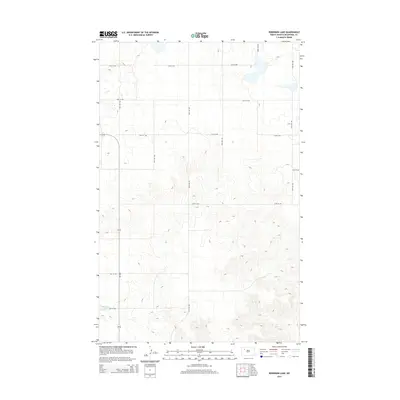
2014 Map of Robinson Lake
USGS Topo · Published 2014About this map
Robinson Lake anchors the southwestern corner of this Mountrail County landscape, where the prairie transitions into a complex of drainage patterns and high-plateau topography. The area is defined by a strict section-line road grid, characteristic of the northern plains, where gravel routes like 90th Ave NW and 57th Ave NW provide access to agricultural parcels and ranch lands. The primary corridor through this quadrant is ND-1804, a route that follows the general path of the Missouri River valley just beyond the map's southern edge. The terrain is notably varied, with elevation contours revealing the dissected breaks and coulees that lead toward the river, while the northern sections maintain a more level, upland profile suitable for dryland farming. This survey captures the rural infrastructure of the Williston Basin before more intensive modern industrial changes, showing the persistent 19th-century survey lines that still dictate the movement of people and goods today.
Find a feature on this map
15 named features on this map. Tap any name to fly to it.
Don’t see what you’re looking for? This feature index may not catch every label — zoom into the map to look around manually.
Map Details
Editions of this 2014 Robinson Lake Map
This is the sole edition of this map. No revisions or reprints were ever made.
Other maps of this area

1953 · Williston
USGS Topo · 1:250,000

1957 · Williston
USGS Topo · 1:250,000

1969 · Stanley
USGS Topo · 1:24,000

1981 · Belden SW
USGS Topo · 1:24,000

1981 · Robinson Lake
USGS Topo · 1:24,000
1981 · Rat Lake SE
USGS Topo · 1:24,000

1981 · Ross
USGS Topo · 1:24,000

1981 · Manitou
USGS Topo · 1:24,000
1981 · Rat Lake
USGS Topo · 1:24,000
1981 · Rat Lake SW
USGS Topo · 1:24,000