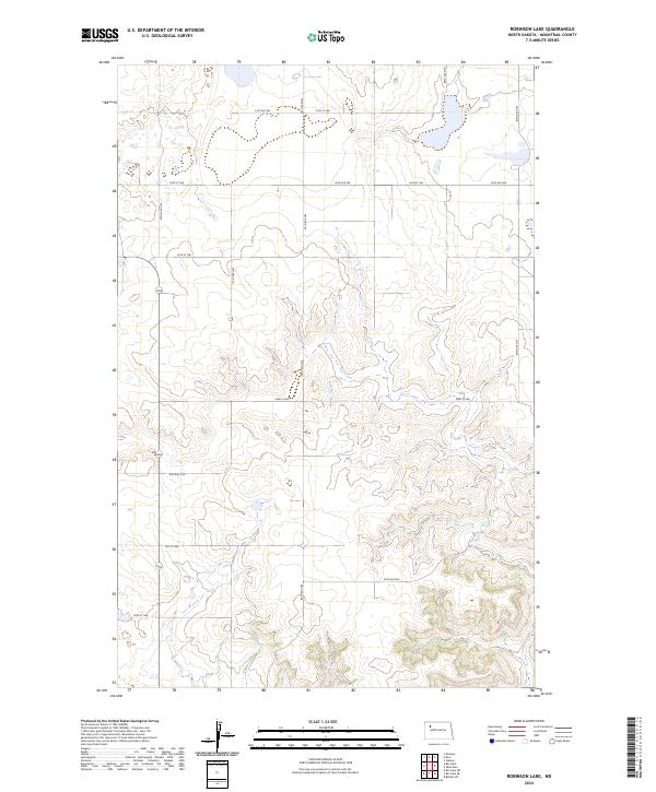
2024 Map of Robinson Lake
USGS Topo · Published 2024About this map
Mountrail County Waterfowl Production Area land dominates the northern and southwestern sections of this landscape, reflecting the conservation-focused land use of modern Mountrail County. The terrain is defined by the Public Land Survey System grid, which is clearly visible through the network of section-line roads such as 91st Ave NW, 90th Ave NW, and 56th St NW. The map illustrates the contemporary rural infrastructure of the High Plains, where vast stretches of undeveloped acreage are partitioned by a precise lattice of secondary highways and local connectors. This 2024 survey documents the persistence of the section-grid layout in North Dakota's agricultural and wildlife management corridors, providing a clear reference for contemporary land boundaries and conservation zones in the region.
Find a feature on this map
18 named features on this map. Tap any name to fly to it.
Don’t see what you’re looking for? This feature index may not catch every label — zoom into the map to look around manually.
Map Details
Editions of this 2024 Robinson Lake Map
This is the sole edition of this map. No revisions or reprints were ever made.
Other maps of this area

1953 · Williston
USGS Topo · 1:250,000

1957 · Williston
USGS Topo · 1:250,000

1969 · Stanley
USGS Topo · 1:24,000

1981 · Belden SW
USGS Topo · 1:24,000

1981 · Robinson Lake
USGS Topo · 1:24,000
1981 · Rat Lake SE
USGS Topo · 1:24,000

1981 · Ross
USGS Topo · 1:24,000

1981 · Manitou
USGS Topo · 1:24,000
1981 · Rat Lake
USGS Topo · 1:24,000
1981 · Rat Lake SW
USGS Topo · 1:24,000