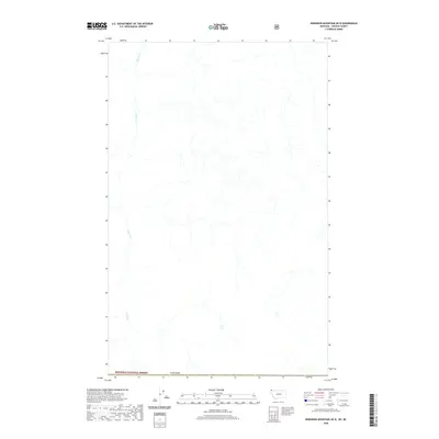
2020 Map of Robinson Mountain OE N
USGS Topo · Published 2020About this map
Kootenai National Forest lands dominate this northern boundary landscape where the United States meets Canada. The area is characterized by a dense network of watercourses, most notably the winding path of Bloom Cr, which flows southward through the western portion of the terrain. This 2020 survey provides a detailed look at the drainage patterns and topographic relief of this isolated region of Lincoln County. The map captures the meeting of international borders and protected forest lands, illustrating a landscape defined more by its natural hydrography than by human settlement or infrastructure. For those researching the geography of the northernmost edge of Montana, it offers a precise record of the headwaters and tributaries that define this trans-border environment.
Find a feature on this map
3 named features on this map. Tap any name to fly to it.
Don’t see what you’re looking for? This feature index may not catch every label — zoom into the map to look around manually.
Map Details
Editions of this 2020 Robinson Mountain OE N Map
This is the sole edition of this map. No revisions or reprints were ever made.
Other maps of this area

1957 · Kalispell
USGS Topo · 1:250,000

1960 · Kalispell
USGS Topo · 1:250,000

1961 · Kalispell
USGS Topo · 1:250,000

1963 · Robinson Mountain
USGS Topo · 1:24,000

1963 · Red Mountain
USGS Topo · 1:24,000

1963 · Mount Henry
USGS Topo · 1:24,000

1979 · Yaak River
USGS Topo · 1:100,000
1997 · Robinson Mountain
USGS Topo · 1:24,000
1997 · Mount Henry
USGS Topo · 1:24,000
1997 · Red Mountain
USGS Topo · 1:24,000