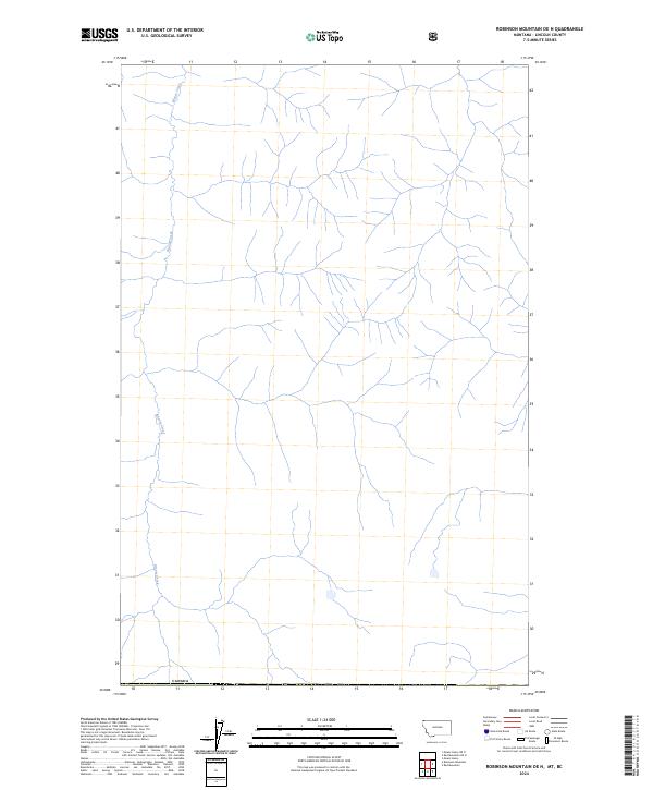
2024 Map of Robinson Mountain OE N
USGS Topo · Published 2024About this map
Bloom Creek winds through the northern reaches of Lincoln County, Montana, providing a focal point for this landscape along the international border. The territory is defined by the sharp demarcation of Canada at the southern edge of the survey area, reflecting the precise geographic boundaries maintained by the U.S. Geological Survey. The drainage patterns shown suggest a remote and undeveloped terrain where the creek's seasonal flow serves as the primary topographical indicator across the high-latitude region. Researchers tracking land management or border geography will find this map essential for understanding the hydrological layout of this quiet corner of the Northwest.
Find a feature on this map
2 named features on this map. Tap any name to fly to it.
Don’t see what you’re looking for? This feature index may not catch every label — zoom into the map to look around manually.
Map Details
Editions of this 2024 Robinson Mountain OE N Map
This is the sole edition of this map. No revisions or reprints were ever made.
Other maps of this area

1957 · Kalispell
USGS Topo · 1:250,000

1960 · Kalispell
USGS Topo · 1:250,000

1961 · Kalispell
USGS Topo · 1:250,000

1963 · Robinson Mountain
USGS Topo · 1:24,000

1963 · Red Mountain
USGS Topo · 1:24,000

1963 · Mount Henry
USGS Topo · 1:24,000

1979 · Yaak River
USGS Topo · 1:100,000
1997 · Robinson Mountain
USGS Topo · 1:24,000
1997 · Mount Henry
USGS Topo · 1:24,000
1997 · Red Mountain
USGS Topo · 1:24,000