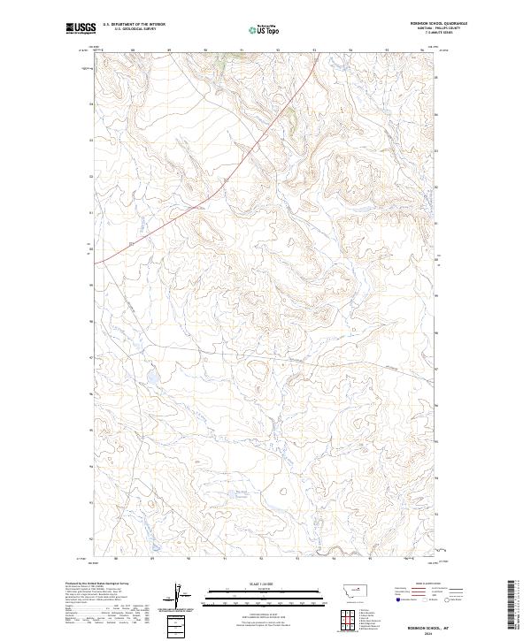
2024 Map of Robinson School
USGS Topo · Published 2024About this map
Big Sage Reservoir and a network of ephemeral drainages define this portion of Phillips County, Montana, as documented in this 2024 survey. The landscape is marked by the branching paths of C K Creek, Camp Creek, and Alder Creek, which carve through the high plains terrain. This modern topographic study reveals a sparsely populated region primarily organized by the Public Land Survey System, with township and range lines like t24n r26e providing the primary structural framework. The presence of routes such as Lazy Jd Rd and Dry Fork Rd suggests the continued importance of ranching and land management access in this northern Montana expanse. Remote water features, including Sevemile Creek and Beauchamp Creek, underscore the hydrological patterns essential to the local environment and agricultural history of the Big Dry country.
Find a feature on this map
14 named features on this map. Tap any name to fly to it.
Don’t see what you’re looking for? This feature index may not catch every label — zoom into the map to look around manually.
Map Details
Editions of this 2024 Robinson School Map
This is the sole edition of this map. No revisions or reprints were ever made.
Other maps of this area

1943 · Landusky
USGS Topo · 1:125,000

1954 · Bell Ridge East
USGS Topo · 1:24,000

1954 · Lewistown
USGS Topo · 1:250,000

1959 · Lewistown
USGS Topo · 1:250,000

1971 · Bear Mountain
USGS Topo · 1:24,000

1971 · Robinson School
USGS Topo · 1:24,000

1971 · Hays SE
USGS Topo · 1:24,000

1971 · Bison Bone Reservoir
USGS Topo · 1:24,000
1971 · Zortman
USGS Topo · 1:24,000
1971 · Coburn Butte
USGS Topo · 1:24,000