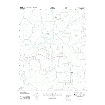
2011 Map of Robinson
USGS Topo · Published 2011About this map
Osage Creek and Wildcat Creek define the drainage of this rural landscape west of Springdale. Small residential and agricultural clusters are scattered throughout the region, including the crossroads of Robinson, Harmon, and Stella. This early 21st-century survey documents the transition of these areas, where long-standing rural routes like Rocky Comfort Road and Osage Farm Road intersect newer developments. To the west, the Illinois River flows through a more sparsely populated corridor. Genealogists will find the Yell Cemetery situated south of Robinson, while the presence of Heda Lake and its associated Heda Lake Dam shows the local water management within the Brush Creek watershed. The map provides a detailed look at the infrastructure of the era, from the Osage Creek Bridge to the intricate network of local lanes.
Find a feature on this map
104 named features on this map. Tap any name to fly to it.
Don’t see what you’re looking for? This feature index may not catch every label — zoom into the map to look around manually.
Map Details
Editions of this 2011 Robinson Map
This is the sole edition of this map. No revisions or reprints were ever made.
Other maps of this area

1899 · Fayetteville
USGS Topo · 1:125,000

1901 · Fayetteville
USGS Topo · 1:125,000

1904 · Fayetteville
USGS Topo · 1:125,000

1954 · Tulsa
USGS Topo · 1:250,000

1958 · Fayetteville
USGS Topo · 1:24,000

1958 · Tulsa
USGS Topo · 1:250,000

1963 · Tulsa
USGS Topo · 1:250,000

1970 · Gallatin
USGS Topo · 1:24,000

1970 · Robinson
USGS Topo · 1:24,000
1970 · Bentonville South
USGS Topo · 1:24,000