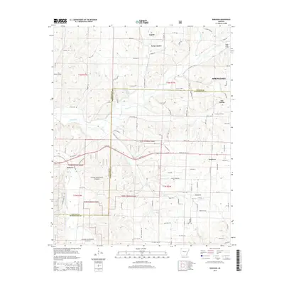
2014 Map of Robinson
USGS Topo · Published 2014About this map
The Ozark National Forest covers the southwestern portion of this landscape, where the wooded hills meet the growing agricultural and residential developments of Northwest Arkansas. Small settlements and rural communities are scattered throughout, including Robinson, Tontitown, and Harmon. The local geography is defined by the winding paths of Osage Creek, Wildcat Creek, and Brush Creek, which drain the undulating terrain between the higher ground of Rocky Comfort and the outskirts of Springdale.
Find a feature on this map
75 named features on this map. Tap any name to fly to it.
Don’t see what you’re looking for? This feature index may not catch every label — zoom into the map to look around manually.
Map Details
Editions of this 2014 Robinson Map
This is the sole edition of this map. No revisions or reprints were ever made.
Other maps of this area

1899 · Fayetteville
USGS Topo · 1:125,000

1901 · Fayetteville
USGS Topo · 1:125,000

1904 · Fayetteville
USGS Topo · 1:125,000

1954 · Tulsa
USGS Topo · 1:250,000

1958 · Fayetteville
USGS Topo · 1:24,000

1958 · Tulsa
USGS Topo · 1:250,000

1963 · Tulsa
USGS Topo · 1:250,000

1970 · Gallatin
USGS Topo · 1:24,000

1970 · Robinson
USGS Topo · 1:24,000
1970 · Bentonville South
USGS Topo · 1:24,000