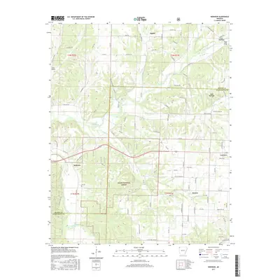
2017 Map of Robinson
USGS Topo · Published 2017About this map
Ozark National Forest lands anchor the southwestern portion of this 2017 survey, where the Illinois River cuts across the corner of the map. This Northwest Arkansas landscape is defined by the headwaters of numerous creeks, including Osage Creek and Wildcat Cr, which drain the plateau between the growing communities of Cave Springs and Tontitown. The area maintains a rural character with a dense network of local roads such as Dallarosa Rd and Reams Rd connecting various small settlements.
Find a feature on this map
100 named features on this map. Tap any name to fly to it.
Don’t see what you’re looking for? This feature index may not catch every label — zoom into the map to look around manually.
Map Details
Editions of this 2017 Robinson Map
This is the sole edition of this map. No revisions or reprints were ever made.
Other maps of this area

1899 · Fayetteville
USGS Topo · 1:125,000

1901 · Fayetteville
USGS Topo · 1:125,000

1904 · Fayetteville
USGS Topo · 1:125,000

1954 · Tulsa
USGS Topo · 1:250,000

1958 · Fayetteville
USGS Topo · 1:24,000

1958 · Tulsa
USGS Topo · 1:250,000

1963 · Tulsa
USGS Topo · 1:250,000

1970 · Gallatin
USGS Topo · 1:24,000

1970 · Robinson
USGS Topo · 1:24,000
1970 · Bentonville South
USGS Topo · 1:24,000