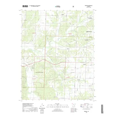
2020 Map of Robinson
USGS Topo · Published 2020About this map
Tontitown and Robinson anchor this survey of the Northwest Arkansas landscape, where the plateau begins to ripple toward the Wedington Twin Mountains. This region is defined by the winding paths of Osage Creek and the Illinois River, which carve through the terrain between established communities like Harmon and Elm Springs. Significant portions of the southwestern quadrant are preserved within the Ozark National Forest, providing a contrast to the developing outskirts of Springdale to the east. For local historians, the map identifies specific points of interest such as the Osage Creek Bridge and family-linked sites including Yell Cem and Burks Cem. The intricate road network, featuring names like Rocky Comfort Rd and Dallarosa Rd, reflects a blend of rural agricultural routes and the expanding suburban reach of the Ozark mountains.
Find a feature on this map
103 named features on this map. Tap any name to fly to it.
Don’t see what you’re looking for? This feature index may not catch every label — zoom into the map to look around manually.
Map Details
Editions of this 2020 Robinson Map
This is the sole edition of this map. No revisions or reprints were ever made.
Other maps of this area

1899 · Fayetteville
USGS Topo · 1:125,000

1901 · Fayetteville
USGS Topo · 1:125,000

1904 · Fayetteville
USGS Topo · 1:125,000

1954 · Tulsa
USGS Topo · 1:250,000

1958 · Fayetteville
USGS Topo · 1:24,000

1958 · Tulsa
USGS Topo · 1:250,000

1963 · Tulsa
USGS Topo · 1:250,000

1970 · Gallatin
USGS Topo · 1:24,000

1970 · Robinson
USGS Topo · 1:24,000
1970 · Bentonville South
USGS Topo · 1:24,000