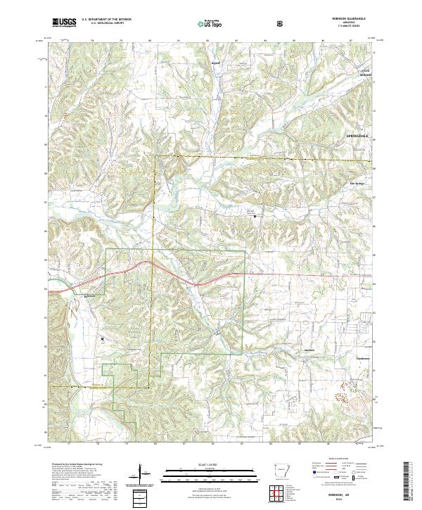
2024 Map of Robinson
USGS Topo · Published 2024About this map
The Benton Co Washington Co line bisects this region of Northwest Arkansas, where the rolling landscape is defined by the headwaters of several prominent creek systems. The community of Robinson sits in the western portion of the map, situated near the Ozark National Forest and the upper reaches of the Illinois River. For genealogists and local historians, several burial sites provide important touchpoints, including the Echo Dell - Burks Cem and the Yell Cem.
Find a feature on this map
72 named features on this map. Tap any name to fly to it.
Don’t see what you’re looking for? This feature index may not catch every label — zoom into the map to look around manually.
Map Details
Editions of this 2024 Robinson Map
This is the sole edition of this map. No revisions or reprints were ever made.
Other maps of this area

1899 · Fayetteville
USGS Topo · 1:125,000

1901 · Fayetteville
USGS Topo · 1:125,000

1904 · Fayetteville
USGS Topo · 1:125,000

1954 · Tulsa
USGS Topo · 1:250,000

1958 · Fayetteville
USGS Topo · 1:24,000

1958 · Tulsa
USGS Topo · 1:250,000

1963 · Tulsa
USGS Topo · 1:250,000

1970 · Gallatin
USGS Topo · 1:24,000

1970 · Robinson
USGS Topo · 1:24,000
1970 · Bentonville South
USGS Topo · 1:24,000