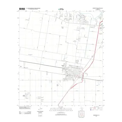
2013 Map of Robstown
USGS Topo · Published 2013About this map
San Pedro and North San Pedro anchor this coastal bend landscape, where the agricultural traditions of South Texas meet the expanding infrastructure of the Corpus Christi area. The map reveals a transition from traditional land use to modern development, most notably at the Robstown Labor Camp and the Robstown Community Hall. Aviation is a central theme of this 2013 survey, which documents the Nueces County Airport alongside smaller specialized facilities like the High Man Tower Airstrip and the crop-focused Rabb Dusting Inc Airport near Rabb. To the northeast, the Nueces River winds past the junction of Five Points, while the southern end of the sheet shows the residential street grids of Spring Gardens. This record illustrates how water, rail-aligned settlements, and agricultural aviation have shaped the development patterns of the region.
Find a feature on this map
133 named features on this map. Tap any name to fly to it.
Don’t see what you’re looking for? This feature index may not catch every label — zoom into the map to look around manually.
Map Details
Editions of this 2013 Robstown Map
This is the sole edition of this map. No revisions or reprints were ever made.
Other maps of this area

1924 · Petronilla
USGS Topo · 1:62,500

1925 · Robstown
USGS Topo · 1:62,500

1950 · Corpus Christi
USGS Topo · 1:250,000

1954 · Orange Grove
USGS Topo · 1:62,500

1954 · Robstown
USGS Topo · 1:62,500

1954 · Kingsville
USGS Topo · 1:62,500

1954 · Petronila
USGS Topo · 1:62,500

1956 · Corpus Christi
USGS Topo · 1:250,000

1960 · Corpus Christi
USGS Topo · 1:250,000

1966 · Corpus Christi
USGS Topo · 1:250,000