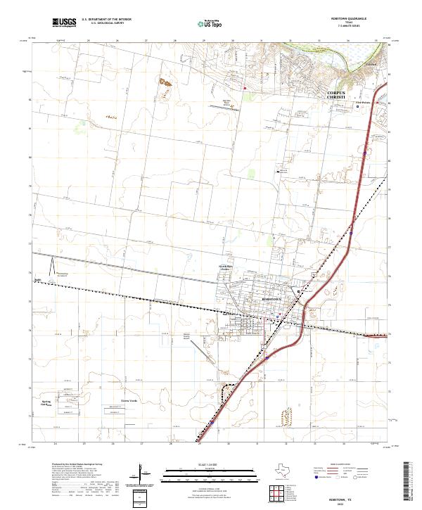
2022 Map of Robstown
USGS Topo · Published 2022About this map
The city of Robstown serves as a major agricultural and transportation hub in the coastal bend region of South Texas. This 2022 survey details the dense street grid and residential expansion of the city, including neighborhoods like San Pedro and North San Pedro, which are closely tied to the area's history. The landscape is characterized by its transition from industrial and municipal sites, such as the Nueces County Airport, to more remote airstrips like High Man Tower Airstrip and Rabb Dusting Inc Airport, reflecting the region's enduring reliance on aerial crop dusting for its surrounding farmlands.
Find a feature on this map
122 named features on this map. Tap any name to fly to it.
Don’t see what you’re looking for? This feature index may not catch every label — zoom into the map to look around manually.
Map Details
Editions of this 2022 Robstown Map
This is the sole edition of this map. No revisions or reprints were ever made.
Other maps of this area

1924 · Petronilla
USGS Topo · 1:62,500

1925 · Robstown
USGS Topo · 1:62,500

1950 · Corpus Christi
USGS Topo · 1:250,000

1954 · Orange Grove
USGS Topo · 1:62,500

1954 · Robstown
USGS Topo · 1:62,500

1954 · Kingsville
USGS Topo · 1:62,500

1954 · Petronila
USGS Topo · 1:62,500

1956 · Corpus Christi
USGS Topo · 1:250,000

1960 · Corpus Christi
USGS Topo · 1:250,000

1966 · Corpus Christi
USGS Topo · 1:250,000