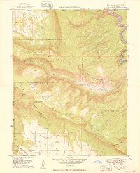
1949 Map of Roc Creek
USGS Topo · Published 1949About this map
Uranium and radium exploration define the mid-century character of this western Colorado landscape, evidenced by the collaboration between the Geological Survey and the United States Atomic Energy Commission. The rugged topography is anchored by the Dolores River in the northeast, while the interior is marked by the distinct geology of Sinbad Valley and the high elevations of Sewemup Mesa.
Find a feature on this map
25 named features on this map. Tap any name to fly to it.
Don’t see what you’re looking for? This feature index may not catch every label — zoom into the map to look around manually.
Map Details
Editions of this 1949 Roc Creek Map
2 editions found
Other maps of this area

1885 · La Sal
USGS Topo · 1:250,000

1916 · Paradox Valley
USGS Topo · 1:125,000

1922 · Paradox Valley
USGS Topo · 1:125,000

1948 · Roc Creek
USGS Topo · 1:24,000

1948 · Paradox
USGS Topo · 1:24,000

1949 · Davis Mesa
USGS Topo · 1:24,000

1949 · Paradox
USGS Topo · 1:24,000

1949 · Roc Creek
USGS Topo · 1:24,000

1949 · Juanita Arch
USGS Topo · 1:24,000

1949 · Red Canyon
USGS Topo · 1:24,000