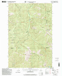
1996 Map of Rochat Peak
USGS Topo · Published 1999About this map
The St Joe Mountains dominate this high-country landscape, where the administrative lines of the Coeur d'Alene Indian Reservation meet the expansive timberlands of the Coeur d'Alene National Forest and the St Joe National Forest. The map documents the Old Indian Reservation Boundary as it traverses the ridges, providing a clear record of historical land tenure and tribal borders in northern Idaho. Watercourses like Latour Creek and Blackrock Gulch drain the steep terrain, carved by peaks such as Rochat Peak and Kootenai Peak. This survey offers researchers a precise view of the interface between wilderness management and sovereign tribal lands in the late 1990s, capturing the topography around the Kootenai Co Benewah Co line and remote landmarks like Crystal Lake.
Find a feature on this map
24 named features on this map. Tap any name to fly to it.
Don’t see what you’re looking for? This feature index may not catch every label — zoom into the map to look around manually.
Map Details
Editions of this 1996 Rochat Peak Map
This is the sole edition of this map. No revisions or reprints were ever made.
Other maps of this area

1903 · Rathdrum
USGS Topo · 1:125,000

1909 · Cataldo
USGS Topo · 1:125,000

1911 · Cataldo
USGS Topo · 1:125,000

1950 · Rochat Peak
USGS Topo · 1:24,000

1950 · Twin Crags
USGS Topo · 1:24,000

1952 · Rochat Peak
USGS Topo · 1:24,000

1952 · Twin Crags
USGS Topo · 1:24,000

1955 · Spokane
USGS Topo · 1:250,000

1957 · St. Maries
USGS Topo · 1:62,500

1957 · Kingston
USGS Topo · 1:62,500