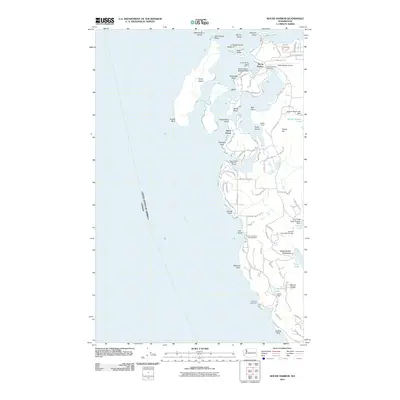
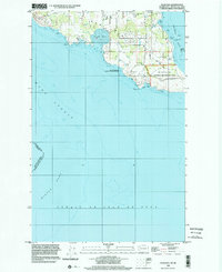
2011 Map of Roche Harbor
USGS Topo · Published 2011About this map
Roche Harbor anchorages and the international maritime boundary with Canada define this 2011 survey of the northwestern San Juan Islands. The landscape is a mix of protected harbors and steep coastal terrain, featuring the significant English Camp site on the eastern shore. Marine infrastructure is prominent, from the Roche Harbor Resort Marina and Roche Harbor Seaplane Base to the historic Lime Kiln Lighthouse watching over Haro Strait. Inland, the map reveals a complex water management system including the Friday Harbor Watershed, Trout Lake, and the Lawson Lake area. Cultural landmarks like the Afterglow Vista Mausoleum and the Lime Kiln itself provide evidence of the area's long industrial and social history, while the proximity of Roche Harbor Airport underscores the modern accessibility of these remote island points.
Find a feature on this map
94 named features on this map. Tap any name to fly to it.
Don’t see what you’re looking for? This feature index may not catch every label — zoom into the map to look around manually.
Map Details
Editions of this 2011 Roche Harbor Map
This is the sole edition of this map. No revisions or reprints were ever made.
Other maps of this area

1953 · Stuart Island
USGS Topo · 1:24,000

1954 · Roche Harbor
USGS Topo · 1:24,000

1954 · Waldron Island
USGS Topo · 1:24,000

1954 · Friday Harbor
USGS Topo · 1:24,000

1954 · False Bay
USGS Topo · 1:24,000

1957 · Victoria
USGS Topo · 1:250,000
1979 · Port Angeles
USGS Topo · 1:100,000
1981 · Roche Harbor
USGS Topo · 1:100,000
1997 · Waldron Island
USGS Topo · 1:24,000
1998 · False Bay
USGS Topo · 1:24,000