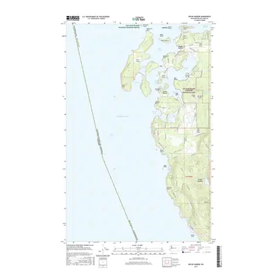
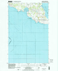
2017 Map of Roche Harbor
USGS Topo · Published 2017About this map
Roche Harbor sits at the northern reach of San Juan Island, serving as a focal point for maritime activity and historical preservation. The area is defined by a complex shoreline of inlets and points, including Westcott Bay and Garrison Bay, where the San Juan Island National Historical Park preserves significant local heritage. Cultural landmarks like the Afterglow Vista Mausoleum reflect the unique social history of the island, while the Roche Harbor Airport and local roads such as Reuben Memorial Dr and Roche Harbor Rd show the infrastructure supporting this coastal community.
Find a feature on this map
95 named features on this map. Tap any name to fly to it.
Don’t see what you’re looking for? This feature index may not catch every label — zoom into the map to look around manually.
Map Details
Editions of this 2017 Roche Harbor Map
This is the sole edition of this map. No revisions or reprints were ever made.
Other maps of this area

1953 · Stuart Island
USGS Topo · 1:24,000

1954 · Roche Harbor
USGS Topo · 1:24,000

1954 · Waldron Island
USGS Topo · 1:24,000

1954 · Friday Harbor
USGS Topo · 1:24,000

1954 · False Bay
USGS Topo · 1:24,000

1957 · Victoria
USGS Topo · 1:250,000
1979 · Port Angeles
USGS Topo · 1:100,000
1981 · Roche Harbor
USGS Topo · 1:100,000
1997 · Waldron Island
USGS Topo · 1:24,000
1998 · False Bay
USGS Topo · 1:24,000