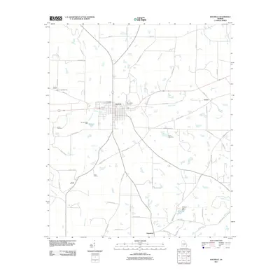
2011 Map of Rochelle
USGS Topo · Published 2011About this map
Rochelle serves as the central hub of this South Georgia landscape, where a grid of town streets meets an extensive network of county roads. The area's agricultural and rural character is defined by a series of family-named cemeteries, such as Evergreen Cemetery, Morningside Cemetery, and Hannah Cemetery, which offer valuable geographic markers for local genealogists. Smaller settlements like Kramer to the east and Owensboro to the south anchor the outlying corners of the quadrangle.
Find a feature on this map
67 named features on this map. Tap any name to fly to it.
Don’t see what you’re looking for? This feature index may not catch every label — zoom into the map to look around manually.
Map Details
Editions of this 2011 Rochelle Map
This is the sole edition of this map. No revisions or reprints were ever made.
Other maps of this area

1953 · Waycross
USGS Topo · 1:250,000

1957 · Macon
USGS Topo · 1:250,000

1958 · Macon
USGS Topo · 1:250,000

1958 · Waycross
USGS Topo · 1:250,000

1964 · Macon
USGS Topo · 1:250,000

1971 · Pineview West
USGS Topo · 1:24,000

1972 · Abbeville North
USGS Topo · 1:24,000

1972 · Pineview East
USGS Topo · 1:24,000

1974 · Rebecca
USGS Topo · 1:24,000
1974 · Abbeville South
USGS Topo · 1:24,000