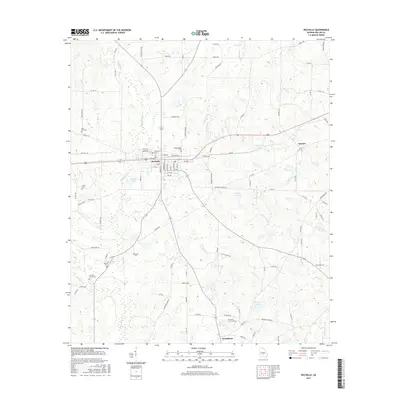
2017 Map of Rochelle
USGS Topo · Published 2017About this map
Rochelle serves as the central hub of this Wilcox County landscape, where an organized grid of streets and avenues meets the rural agricultural reaches of southern Georgia. The surrounding countryside is defined by a dense network of family and community burial grounds, including Evergreen Cem, Morningside Cem, and Pine City Cem, which offer significant value for genealogical research. To the east and south, the terrain becomes increasingly defined by water, as House Cr and Mill Cr snake toward the Alapaha River at the southwestern corner. This area includes several named bodies of water such as Morrison Lake, Pierce Lake, and Anderson Lake. Small settlements like Kramer and Owensboro are linked to the county seat by a system of county roads, reflecting the long-standing transport patterns of this rural region.
Find a feature on this map
108 named features on this map. Tap any name to fly to it.
Don’t see what you’re looking for? This feature index may not catch every label — zoom into the map to look around manually.
Map Details
Editions of this 2017 Rochelle Map
This is the sole edition of this map. No revisions or reprints were ever made.
Other maps of this area

1953 · Waycross
USGS Topo · 1:250,000

1957 · Macon
USGS Topo · 1:250,000

1958 · Macon
USGS Topo · 1:250,000

1958 · Waycross
USGS Topo · 1:250,000

1964 · Macon
USGS Topo · 1:250,000

1971 · Pineview West
USGS Topo · 1:24,000

1972 · Abbeville North
USGS Topo · 1:24,000

1972 · Pineview East
USGS Topo · 1:24,000

1974 · Rebecca
USGS Topo · 1:24,000
1974 · Abbeville South
USGS Topo · 1:24,000