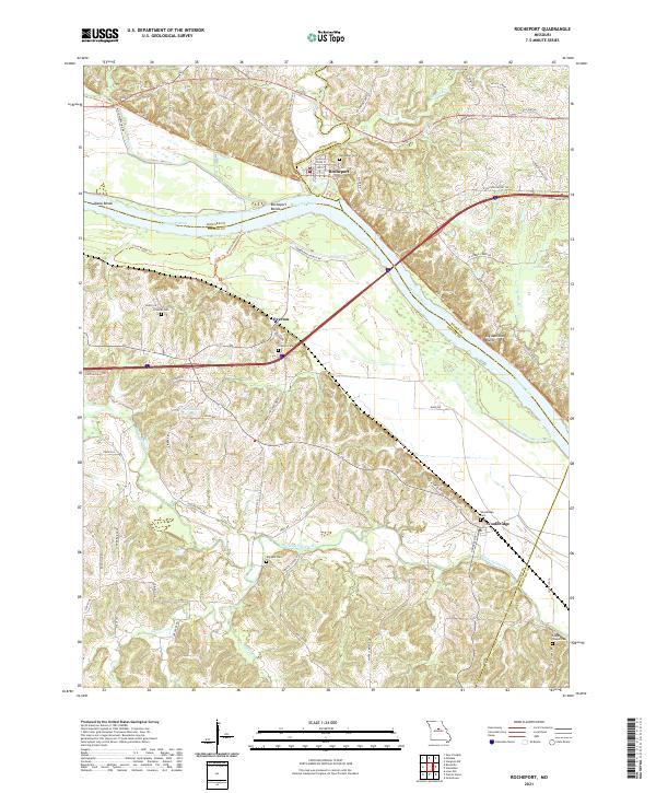
2021 Map of Rocheport
USGS Topo · Published 2021About this map
Rocheport sits at the northern edge of this Missouri riverfront landscape, where the historic town plan meets the high ground of Big Manitou Bluffs. The map illustrates a region defined by the winding course of the Missouri River, featuring dramatic river bends such as Diana Bends and Rocheport Bends. Just across the water, the small settlement of Overton and the low-lying Overton Bottoms Trl represent the floodplain geography of the era. To the south, the village of Wooldridge and several family burial grounds, including Schmidt Cem and Copps Chapel Cem, provide essential data for local historians. Modern recreation is highlighted by the Katy Trl and Little Muddy Trl, which follow the legacy of the river's rail-and-transportation history through Boone, Howard, and Cooper counties.
Find a feature on this map
69 named features on this map. Tap any name to fly to it.
Don’t see what you’re looking for? This feature index may not catch every label — zoom into the map to look around manually.
Map Details
Editions of this 2021 Rocheport Map
This is the sole edition of this map. No revisions or reprints were ever made.
Other maps of this area

1886 · Jefferson City
USGS Topo · 1:125,000

1888 · Boonville
USGS Topo · 1:125,000

1890 · Moberly
USGS Topo · 1:125,000

1890 · Glasgow
USGS Topo · 1:125,000

1894 · Jefferson City
USGS Topo · 1:125,000

1917 · Sturgeon
USGS Topo · 1:62,500

1947 · Jefferson City
USGS Topo · 1:250,000

1948 · Columbia
USGS Topo · 1:62,500

1950 · Columbia
USGS Topo · 1:62,500

1952 · Rocheport
USGS Topo · 1:24,000