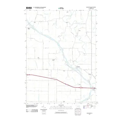
2010 Map of Rochester
USGS Topo · Published 2010About this map
Rochester sits at a critical bend of the Cedar River, where the landscape transitions from the riparian lowlands of Green Bay Bottoms to the agricultural uplands of Cedar County. This 2010 survey highlights a deeply established rural cemetery network, including Mathews Cemetery, Mount Zion Cemetery, and the Pee Dee Cemetery near the settlement of Pedee. These sites, along with others like Kiser Cemetery and Goodale Cemetery, serve as significant markers of early settlement patterns and family lineages in the region.
Find a feature on this map
56 named features on this map. Tap any name to fly to it.
Don’t see what you’re looking for? This feature index may not catch every label — zoom into the map to look around manually.
Map Details
Editions of this 2010 Rochester Map
This is the sole edition of this map. No revisions or reprints were ever made.
Other maps of this area

1889 · Tipton
USGS Topo · 1:62,500

1890 · Tipton
USGS Topo · 1:62,500

1891 · Mechanicsville
USGS Topo · 1:62,500

1891 · Wilton Junction
USGS Topo · 1:62,500

1894 · Mechanicsville
USGS Topo · 1:62,500

1894 · West Liberty
USGS Topo · 1:62,500

1901 · Stanwood
USGS Topo · 1:125,000

1953 · Wilton Junction
USGS Topo · 1:24,000
1953 · Tipton East
USGS Topo · 1:24,000
1953 · Lime City
USGS Topo · 1:24,000