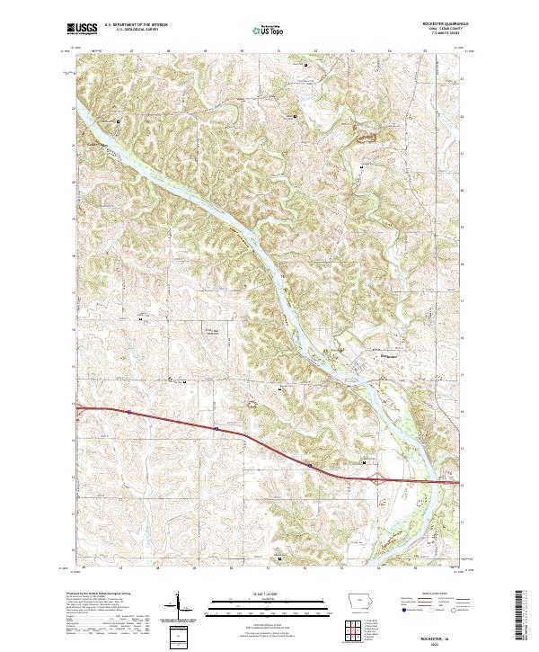
2022 Map of Rochester
USGS Topo · Published 2022About this map
Cedar Valley and Rochester stand as the primary settlements along the winding path of the Cedar River in this part of Cedar County. The river's influence is evident in the broad alluvial plain of Green Bay Bottoms, while the surrounding upland terrain is dissected by numerous waterways including Rock Run Cr, Pee Dee Cr, and Crooked Cr. A dense network of local roads and highways like Co HWY x40 and Cedar Valley RD connects these rural communities, reflecting a landscape long defined by agricultural land use.
Find a feature on this map
48 named features on this map. Tap any name to fly to it.
Don’t see what you’re looking for? This feature index may not catch every label — zoom into the map to look around manually.
Map Details
Editions of this 2022 Rochester Map
This is the sole edition of this map. No revisions or reprints were ever made.
Other maps of this area

1889 · Tipton
USGS Topo · 1:62,500

1890 · Tipton
USGS Topo · 1:62,500

1891 · Mechanicsville
USGS Topo · 1:62,500

1891 · Wilton Junction
USGS Topo · 1:62,500

1894 · Mechanicsville
USGS Topo · 1:62,500

1894 · West Liberty
USGS Topo · 1:62,500

1901 · Stanwood
USGS Topo · 1:125,000

1953 · Wilton Junction
USGS Topo · 1:24,000
1953 · Tipton East
USGS Topo · 1:24,000
1953 · Lime City
USGS Topo · 1:24,000