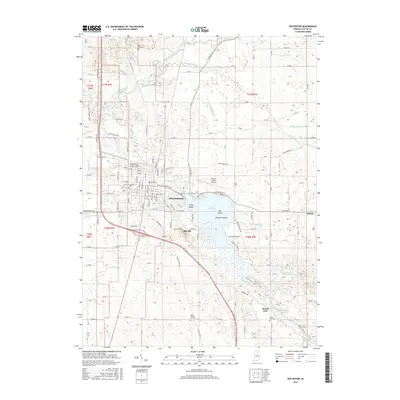
2016 Map of Rochester
USGS Topo · Published 2016About this map
Lake Manitou dominates this portion of Fulton County, serving as a focal point for the city of Rochester. The lake's irregular shoreline is punctuated by several named landforms, including Coney Island, Big Island, and Treasure Island, which contrast with the surrounding agricultural grid. This landscape is intricately drained by a network of man-made and natural watercourses like the Whittenberger-Eiler Ditch and Rain Cr, which eventually feed into the Tippecanoe River in the north.
Find a feature on this map
176 named features on this map. Tap any name to fly to it.
Don’t see what you’re looking for? This feature index may not catch every label — zoom into the map to look around manually.
Map Details
Editions of this 2016 Rochester Map
This is the sole edition of this map. No revisions or reprints were ever made.
Other maps of this area

1953 · Chicago
USGS Topo · 1:250,000

1953 · Danville
USGS Topo · 1:250,000

1955 · Danville
USGS Topo · 1:250,000

1956 · Danville
USGS Topo · 1:250,000

1957 · Chicago
USGS Topo · 1:250,000

1959 · Mentone
USGS Topo · 1:24,000

1960 · Fulton
USGS Topo · 1:24,000

1960 · Macy
USGS Topo · 1:24,000
1960 · Deedsville
USGS Topo · 1:24,000

1962 · Pershing
USGS Topo · 1:24,000